Hiking Papa Stour’s dramatic west coast
Papa Stour’s dramatic west coast
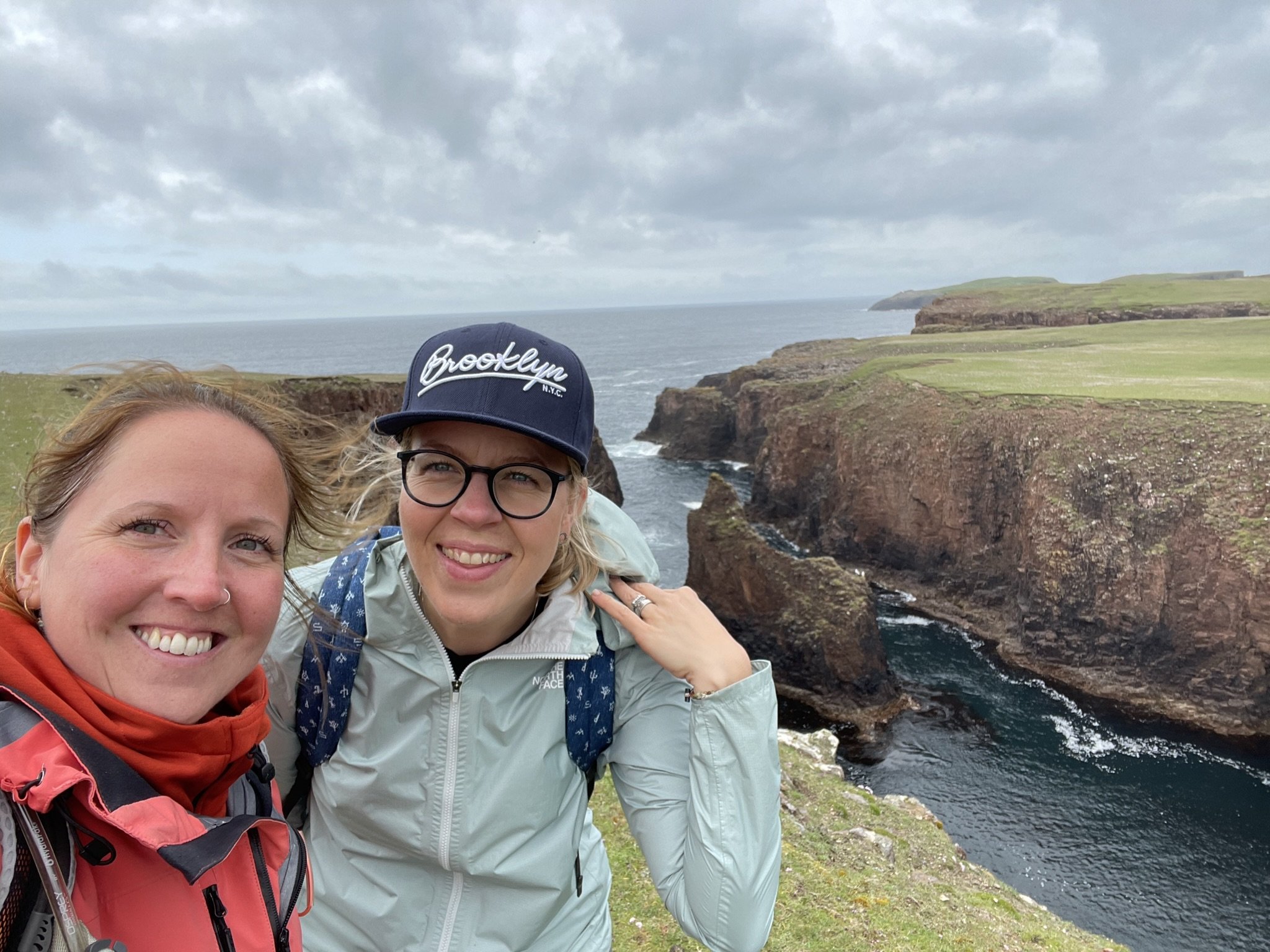
I feel blessed this summer, the weather has been kind, and I’ve allowed enough flexibility in my diary for some fantastic island adventures. One of the islands which I’ve been desperately trying to revisit was Papa Stour, off the west coast of Shetland’s mainland.
We landed in Papa on a beautiful June day which, once the overnight rain cleared and the low cloud lifted, threw golden beams of sunshine over the island, bathing the red granite in light and warmth. The summer breeze carried the scent of now-spent sea pinks over the land, conjuring up memories of milky childhood summers spent outdoors without a care.
A mile offshore from Sandness, accessible several times a week by ferry from West Burrafirth, is Papa Stour, known locally as Papa. The name comes from the Old Norse language, meaning ‘the great island of the priests’.
The island is geologically fascinating, formed from volcanic ash and lava, which is a real gift to hikers seeking the drama, allure and breathtaking vistas offered by the incredible coastline.
Although the ferry allows cars, Papa Stour is best explored on foot and taking a vehicle is optional as the road is only a mile and a half long. A circular walk (11 m / 17 km) will get you around most of the island in a day.
The ferry to Papa must be booked in advance.
* Call the Ulsta Booking Office at +44(0) 1595745804 or visit the Shetland Ferries website at https://www.shetland.gov.uk/ferries/ferry-booking for more information.

Derelict croft in Papa Stour
This fertile and lush island had a population of 382 in 1841, which has declined steadily over the past 40 years. Drifting around the island, Papa’s greatest treasure, George P.S. Peterson’s words spring to mind:
““In imagination and memory, I often walk again the old familiar paths among the whispering corn rigs.””
What I wouldn’t give to step back 100 years to an island whose rigs are alive with the sound of families busily making ready for winter and tending crops …
Today, the 15 or so permanent residents no longer have a school or shop, and there are few facilities on the island for visitors beyond the ferry waiting room and church, which is undergoing renovation. Despite this, Papa is an island that calls to be explored, offering endless hours of enjoyment along its rugged coastline. The main settlement centres around the ferry harbour on the fertile east coast of the island at Housa Voe.

What the island lacks in amenities, it makes up for in its breathtaking rocky coastline, punctuated by caves, geos, gloups [sea cave where the landward end has collapsed], arches, boulder beaches, and stacks formed by volcanic rock and ash and eroded over millennia by the unrelenting Atlantic Ocean.
For hikers – as we were on this June morning – the coastline between Virda Field (285ft) and Hamnavoe, on the island’s west coast, is one of the best in Shetland. You can either walk from the ferry or, if you have a car, park at the disused airfield and complete a 6.5 mile (10.5 km) circular which takes in the dramatic west coast, including Kirstan’s Hol, Aisha Stack, Sula Stack, Aisha Head, Da Snolda and Virdi Field. This moderate hike will take around three hours, but allow extra time for a picnic to enjoy the breathtaking views. Please be careful when walking, particulalry around the cliffs where they may be crumbling and loose in places.
We had taken the car, and after having it secured with wedges to the ferry’s deck against the gentle swell, we parked at the former island’s airstrip and set off towards Hamnavoe.

Hamnavoe, Papa Stour
The enclosed bay of Hamnavoe was once an important trading area where Dutch traders landed goods. The nearby Dutch Loch takes its name from this trade, and several traditional click mills stand in ruin along the burn, fed from the loch towards the sea. Throughout the island, remains of former water mills stand as a testament to the population that the island once supported.
Nearby, the remains of several ‘meal roads’ can be seen. Meal roads were constructed throughout the Highlands and Islands in the 19th century, with the first commissioned in the 1840s. Known as the Hungry 40s, this period was punctuated by crop failures that led to famine throughout Shetland. Authorities ordered the building of roads, and workers were paid in oatmeal or flour, known as meal.

Walking on from Hamnavoe, following the weather-worn coastline, we stopped for a picnic in one of the many beautiful geos. This is not an ascent for the faint-hearted, and I’d be lying if I said that I didn’t have heart palpitations as I tentatively made my way down the rope onto the boulder beach, palms chafing on the worn rope. However, once down, with the towering cliffs cocooning us from the wind and the sun beating down, any misgivings I’d had were washed away – there was no better place for a cup of tea and ham sandwich! That said, this is not an ascent that anyone should undertake unless they are sure they can manage it. The gravel slope was slippery underfoot and quite tough to navigate. I placed too much faith in the worn rope and would likely advise that you admire the geo from the top!
Kirstan’s Hol, Papa Stour
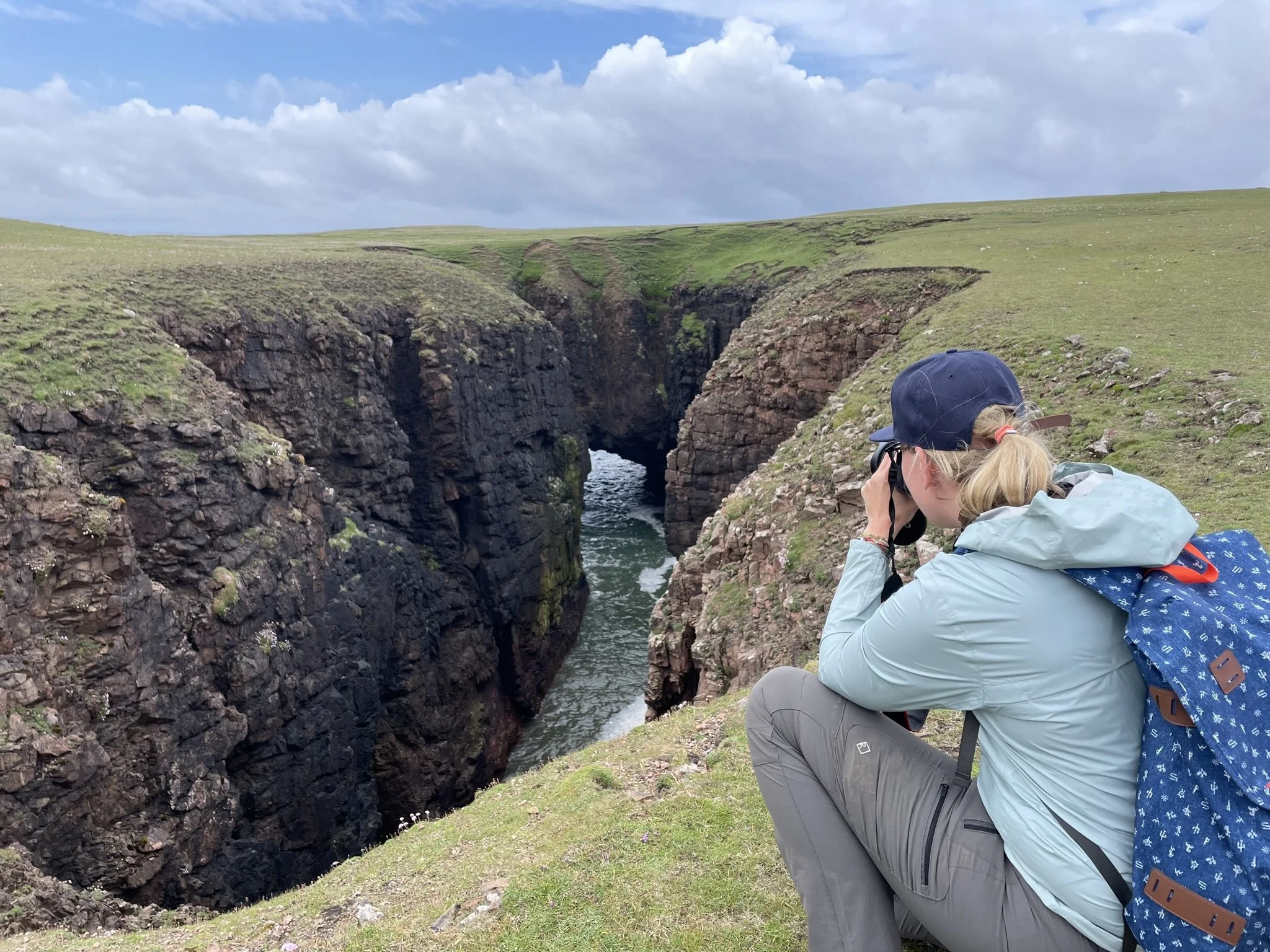
One of the most impressive features we came across on our walk of the island’s west coast is Kirstan’s Hol, an impressive gloup that extends inland from the fractured, storm-battered coastline. Inland further, another hole, ‘New Kirstan’s Hol’, has formed more recently, with fresh landfall evident around the dizzying perimeter of this great chasm.
From here, we followed the coast towards Virda Field, passing the impressive features of Aisha Stack, Sula Stack, Aisha Head and Da Snolda.

Terns in Papa Stour
Papa is an island which belongs to the wildlife; we were swooped and dived by noisy colonies of terns, their shrill cries piercing the summer air before being silently, stealthily ambushed by the great skuas who sneak up and pass with threatening urgency in a swoosh of wings and menacing rush of air.
With one eye on the clock, we cut the corner at Virda Field, where Da Hol o Boardie, a subterranean passage, one of the longest sea caves in the world at 330 metres long, slices through the island.

Heading back to the car, the gentle landscape around Culla Voe reminded us once more of the security this island once offered generations of crofting families who tirelessly worked the land, their lives still etched across the landscape in the form of ruined houses, watermills and field systems.
After a pit stop at the ferry waiting room, which offers toilets, tea and coffee-making facilities and several small souvenirs, we headed for one final walk before the ferry returned from the mainland to collect us again.
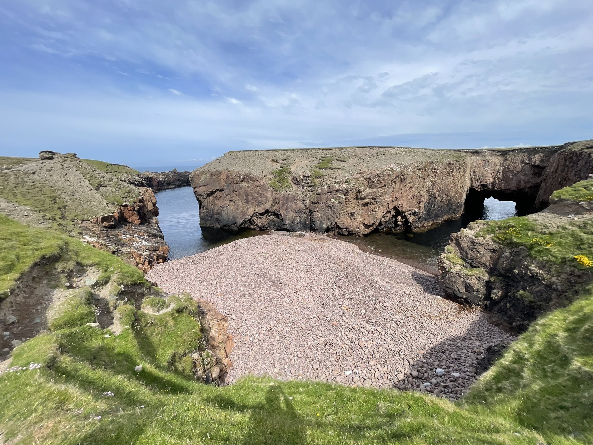
We chose a more leisurely walk that leads half a mile (0.8km) from the ferry towards Geubery Head on the island’s eastern side. Here, a short scramble down to the stone beach was the perfect place to enjoy the last remnants of our picnic and watch the waves crash in on the beach through a beautifully carved natural arch. Just as we were considering a swim, a tide surge thundered onto the beach, reminding us again of the perilous stretch of water separating this incredible island from the mainland.
We laced our boots up once more and trudged back to the ferry; bones tired, faces sunkissed and limbs heavy, our hearts were full as the ferrymen welcomed us onboard for the short crossing back to West Burrafirth.


Our route for the first hike, taken from the OS app
Ways you can support my work…

